How Supercomputers Are Making Hurricane Forecasting Much Easier

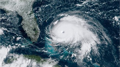
(Source: NOAA/CIRA/RAMMB/CNN)
Don’t curl into a ball and start sucking your thumb, though, because there is some good news: We are getting a lot better at tracking these monsters.
After Hurricane Sandy tore through the East Coast in 2012, Congress approved more than $80 million in supplemental funding for the National Weather Service (NWS) to spend on improving its storm forecasting and tracking capabilities. That money went to investing in supercomputers for the agency and research and development. This investment in supercomputing means the agency can more quickly process information it receives from its storm tracking satellite, the GOES-16 (originally called the GOES-R, and data it receives from buoys, aircrafts, and other sources.
Read the full article here:
https://www.inverse.com/article/58975-hurricane-dorian-predicting-technology-climate
